Upper Murrumbidgee Waterwatch is a community‑based citizen science program that partners with volunteers to monitor waterways, rivers, creeks and wetlands across the Upper Murrumbidgee catchment.
For more than 30 years, Waterwatch has supported the collection of high‑quality, long‑term environmental data used to assess catchment health, inform land and water management, and support Government reporting, planning and decision‑making.
What We Do
We connect people with their local waterways by:
Supporting volunteer‑led environmental monitoring
Building understanding of catchment processes and waterway health
Providing reliable, consistent data to guide management, restoration and protection
Community participation is central to delivering evidence‑based environmental outcomes.
Monitoring and Citizen Science
Trained volunteers collect scientifically robust data at dedicated monitoring sites across the catchment. Core programs include:
Monthly water quality monitoring, measuring seven key indicators
Seasonal water bug (macroinvertebrate) surveys
Riparian condition assessments, focusing on riverbank vegetation and stability
Platypus Month surveys each August
Together, these programs provide a comprehensive picture of waterway condition over time.
Our Partners
Upper Murrumbidgee Waterwatch is delivered in partnership with the community.
The program is currently delivered by the following partners:
In 2025, Waterwatch contributed to ACT priorities for water quality, ecosystem health, biodiversity protection and climate resiliencethrough catchment‑wide community‑led monitoring.
FrogWatch participation contributing to frog population and habitat knowledge
Planning & Decision Support
Data used for catchment health reporting
Supports early identification of change and adaptive management
Contributes to evidence‑based land and water management decisions
Data and Reporting
Waterwatch delivers one of the region’s longest‑running community water monitoring datasets.
Data collected by trained volunteers supports the Catchment Health Indicator Program (CHIP),
contributes to ACT Government water reporting, and assists with early identification of
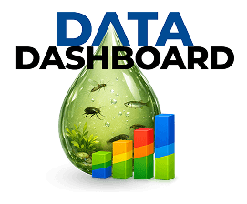
changes in waterway condition. All data is publicly accessible through the Waterwatch Database
and Data Dashboard.
Why Waterwatch Matters
Long‑term monitoring helps identify gradual change, emerging pressures and the outcomes of
management actions. By combining community participation with scientifically credible data and
open access reporting, Waterwatch supports healthier waterways and more
resilient catchments across the Upper Murrumbidgee.
Get Waterwatch Updates
Be the first to hear about volunteer opportunities, events, and news from our waterways.